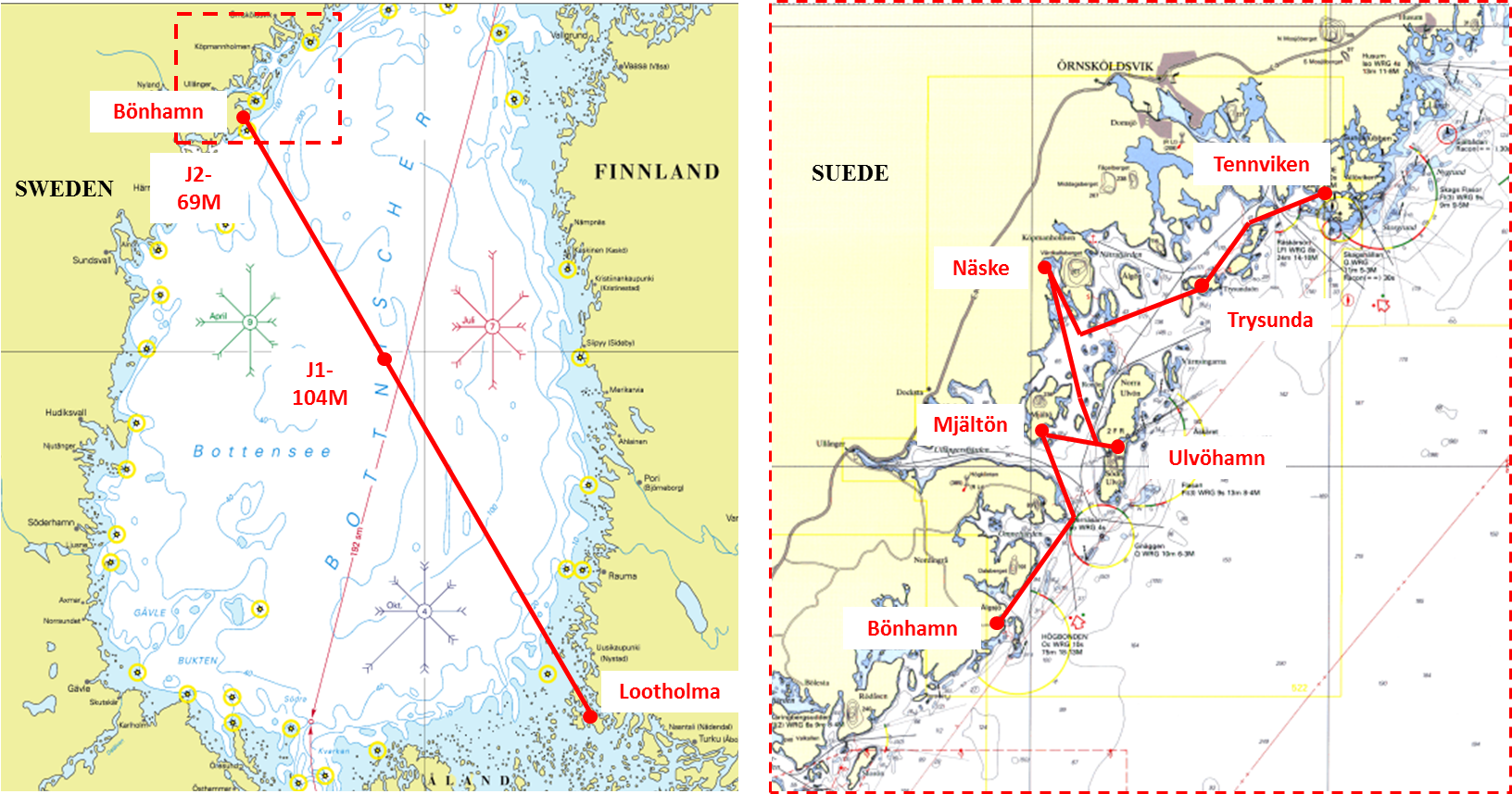
Change of scenery with this escapade
on the other side of the Bothnian Sea: direction the "Höga Kusten", or
High Coast, in Sweden. The surroundings are … higher (yes!), offering
hilly perspectives. And nothing but a warm sun and dry sky. We are at
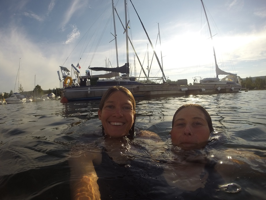
63 ° 12'83''N, the record of the most northerly point ever reached by
Saltimbanque, and we swim in the sea every day.
More still-pink-but-almost-reddish rocks on our page "Pictures".
It’s
been several days and the weather remains stable: a strong high is
camping over the Gulf of Bothnia, ensuring warm weather and little
wind. When the forecast starts showing a gentle breeze from the North
then East, we grab the opportunity to go and explore further North.
Instead of tacking along the Finnish coast, we decide to sail one long
leg close to the wind, until Sweden on the other side of the Sea of
Bothnia.
So we set
sails from Lootholma in the morning calm, motoring the 8nm out of the
channel (which is too narrow to sail against the wind anyways).
Once we reach the last rocks on the northern border of the archipelago,
we hoist all sails and stop the engine (aaaaaaahh ! less noise!). We
are expecting to tack again and again between rocky islands before
reaching the open sea. And so we tack for a first time, keeping a close
eye on the compass and the other on the map. Sailing close, sailing
close… we pass a first beacon… the wind veers slightly and we pass a
second island… then another one …
On a perfect course with closely trimmed sails, we reach Isokari
island, the last of the archipelago. Some more rocks under water are
passed equally easily. Next is a protection area for seals. Bob (the
windvane) is now steering and clears this last obstacle brilliantly.
Soon the end of Kustavi channel and the exit from Turku archipelago
We can't get enough of the long nights...
All
of a sudden we find ourselves in open water – and completely alone. The
thousands of holiday-makers cruising the archipelago do not often
venture outside of it. During the next 36 hours we will see only 4
cargo ships (from a distance) and another big dead animal.
What
a trip! We leave the rocky islands of Turku Archipelago with the full
main sail and the genoa up, sailing close to the wind on starboard
tack. During 36 hours, we will not touch anything. No need to maneuver
at all. Only a few degrees correction to Master Bob, but otherwise but
only have to sit back, relax and enjoy the sunny ride!
Swedish summer !
Arriving to the Swedish High Coast
There
is a little bit of swell at the beginning, but it calms down quickly
enough. The sea is beautiful, the sky is blue, the wind is perfect… so
that our reaction is unusual when we sight land on Day 2 at 5pm:
“already!...”
The mountainous coast is visible from far away and we have 30 nm still
to cover. The last hours are the best: watching the land slowly grow,
set against the never-ending twilight…
At
1am we enter Bönhamn harbor, one of the famous old-turned-touristic
fishing harbors of the region. There are 3 guest quays around the
harbor – mooring is rear anchor and stern to the wooden quay. The
holding is good on 2 to 4m depth (deeper outside, shallower inside),
but the shelter from the North is not perfect.
A few hours
of sleep later, we are ready to explore our new garden. Bönhamn is
located in a bay surrounded by granite rocks and full of dark red
wooden fishing huts. No doubt, this is Sweden! Weird feeling to have
sailed 2000 nautical miles and be in such familiar surroundings.
Something is different from our beloved Bohuslän though: it is not
possible to pay the harbor fees by card – and no app! There is a box to
deposit 130 SEK. We leave 15€ instead… this cover water but no
electricity. 10 SEK coins are needed for the showers, which we don’t
have either… that’s ok, the sea is warm…
Saltimbanque right in the middle of Bönhamn
Homo sapiens finding it difficult to adapt to extreme conditions about 300km away from the polar circle...
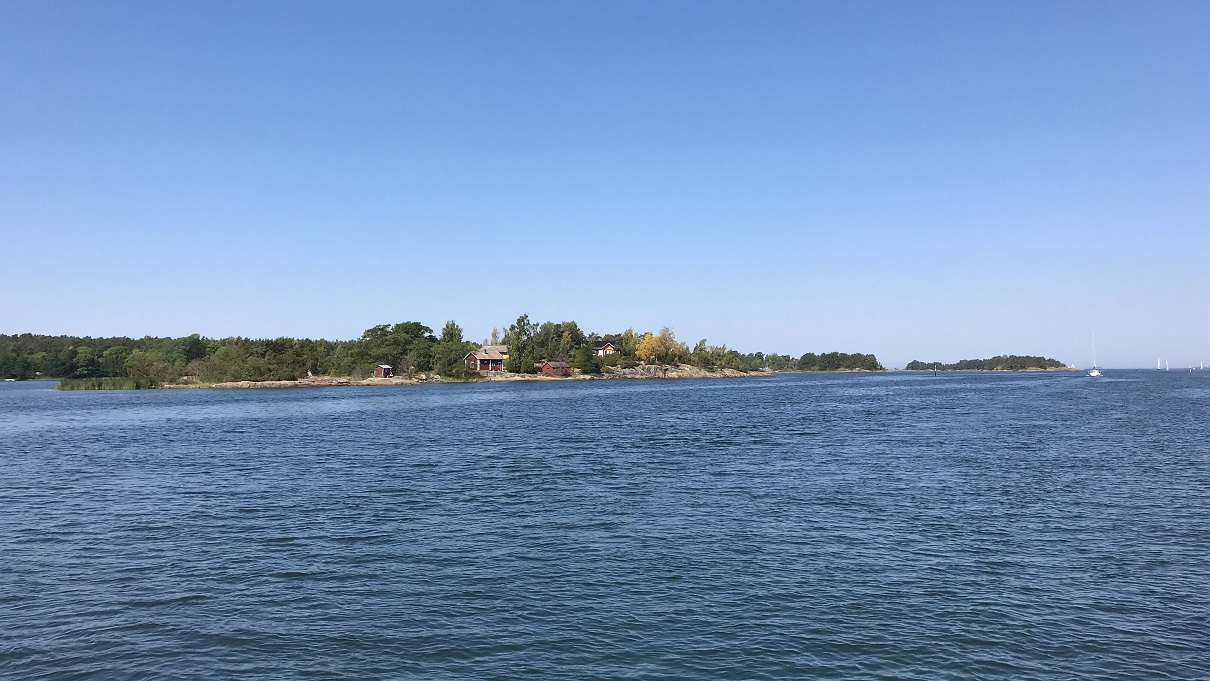
After
walking through the wooden huts around the bay, we start on the nature
trail heading South. Blueberries are ripe here too – we make a note and
come back later to pick some! At the tip of the peninsula, smooth rocks
make for a well-appreciated beach suitable for families. Walking just a
little further, we find a lonely spot at the bottom of steep granite
cliff, making a beach suitable for Saltimbanque’s bathing.
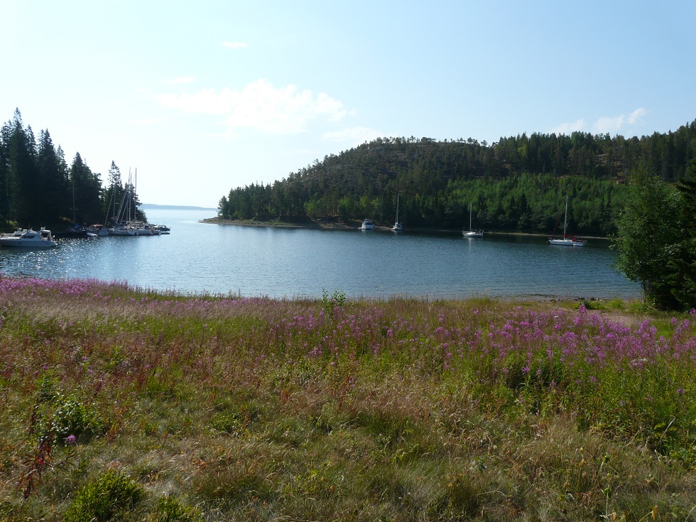
In
the afternoon, we sail to our next anchorage: Baggviken, a real and
round lagoon in the South East of Mjältön Island. The entrance is
narrow and shallow (3m), but there is ample space and good depth (4-6m)
inside. Several short pontoons are offered for visitors (contribution
50 SEK appreciated), but most are full. Another couple of yachts are
moored with their sterns tied to trees.
As for us, we prefer to
trust our bow anchor and drop it in the middle of the bay, swinging
happily a little distance away from other visitors and from mosquitoes
(both being inconvenient when one wishes to have a shower in the
cockpit). Our thermo-sounder indicates 21.6 °C in the water and more
than 30 °C inside the boat. I repeat: we are at 63° North, 3 degrees
away from the Polar Circle.
Saltimbanque in the perfectly round-shaped lagoon
19th July : Baggviken – Ulvöhamn – Näske (15M)
These rocky plains are moraines coming from glaciers, nicely tidied up by the sea when it reached this level
Once upon a
time – a long long time ago – the region was covered by ice. Glaciers,
several kilometers deep, compressed the earth under their weight. The
ground was thus depressed, 800 m below its original level. At the end
of the last ice age, the glaciers melted away liberating the rocks from
their weight. Since then, the ground has risen back by about 500m. This
phenomenon of “rebound”, called “isostatic” by scientists, is ongoing
and nowhere stronger than here, in the High Coast of Sweden – and just
across the Gulf in the Kvarken region of Finland. The ground rises by
8.5 mm by year (or 85cm by century!). Within a generation, people see
new islands appear, bays turn into lakes… in 2500 years, Sweden and
Finland will be linked here and the North of the Gulf of Bothnia will
be a lake...
Mjältön
Island happens to be the highest island in Sweden, towering at 236 m
(Norwegians, don’t laugh!). Which means that we have to climb to the
top of course. Even better: since the island is always growing, the top
is actually higher by the hour. Everyone who climbs to it is therefore
beating the record of the highest island climb in Sweden :o) This
is a nice motivation to walk up under the burning sun (even at
10am)
Tradition
has that every hiker brings a rock to build up the cairn at the top.
Also efficient to help raising up the sumbit altitude...
View over the other granit islands
Here
is too, Granite is king. Along the coastline various shades are
displayed, from salmon pink to dusty red to a classical grey, even
cream white. In every little crack grow tiny pine trees or dried moss.
Without looking at statistics, the state of the local vegetation tells
us that this is not a normal weather. Sweden is current in wild fire
crisis mode, today more than 60 fires have been registered, and the
authorities struggle to cope. This is what the news say – as for us we
will only see one plume of smoke in the distance, and the many
billboards saying that under the circumstances, barbecues are forbidden
(which must mean that the situation is serious, Swedes are fond of
their barbecues…)
Feeling
hungry after our morning walk, we head to Ulvöhamn to grab some lunch.
This harbor was founded in the 16th century by the Gävle fishermen.
Gävle is a town about 400 km South of here, that enjoyed the royal
privilege to control herring fishing over the whole Sea of Bothnia at
that time. The whole coast has been thus populated by Gävle fishermen
who built small settlements on the islands. Ulvön in particular
retained a reputation as the “surströmming” capital. This Swedish
delicacy is well known for being the smelliest food on earth: it is
essentially rotten herring in a can - and is banned from travelling in
planes for fear of explosion. Unfortunately (?) it is not the official
season to taste fresh surströmming and the vendor discourages us from
carrying a can back home in a boat without a fridge. Too bad.
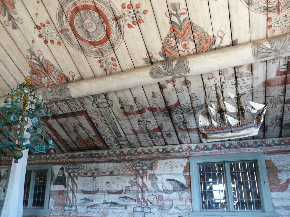
We
resort to “normal” marinated herring and ice-creams, which are always
good and cheap in Sweden. We also enjoy visiting the tiny chapel from
the 16th century, covered with naïve paintings describing harpoon
fishing and stages of life. At the time of the Gävle fishermen, there
used to be only two services a year in the chapel, performed by an
itinerary bishop who wandered along the coast – and was paid in fish
only!
Great historical paintings in the Ulvöhamn chapel
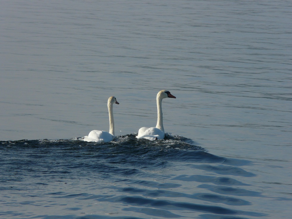
Swans getting speed
Finally
sated, we can continue towards our evening stop, 10 nm further in Näske
Bay. The sea breeze is drawing out and we alternate motoring and
sailing, enjoying the scenery and the bird sanctuary we pass, and
racing with some swans.
Näske
harbor is mainly occupied by resident boats and it is visibly a good
place for winter storage and maintenance. Guests are welcome if there
is space, preferably at the end of the pontoons. In July many residents
are out and there is space aplenty. The depth is good (6.5m), there is
water and electricity (for pay), and dry toilets (and many showers but
they may be locked, we haven’t tried). Guests are invited to write
their name in a book and deposit 60 SEK in a box.
Finding cash is again an issue: this time we ask for more change when we buy some fresh salmon from the fishfarm next door.
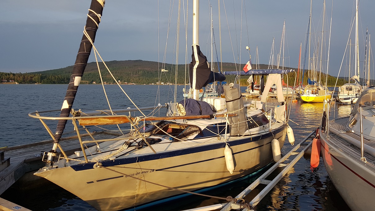
Saltimbanque in Näske, we haven't seen many neighbours
This
is no coincidence that we took a berth in Näske. We were planning to
visit the National Park, where the highest point of the coast is
located and whose entrance is but a few kms from the harbors. Today is
hiking day! Well-shoed and merry we start on the road, despite the
annoying horseflies dwelling around the park and the warm sun. We will
walk 28km in the day, in forests, along lakes, on high summits and
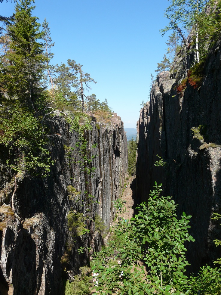
inside the famous crevasse (which the park is popular for).
The
views are just stunning, the colors so bright under the sun, the
landscape yet again different from everything we’ve seen so far. We are
happy to have sailed that far North, to this part of the Baltic often
overlooked by visitors.
Astonishing views from the top
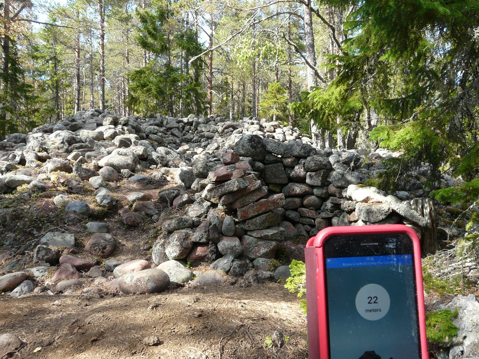
These
ruins of prehistorical dwellings are now at 22m of height according to
our altimeter. Given a yearly raise of 8,5mm and considering the house
was built by the sea, you may date the ruins!
Here
too the “rebound” is perceptible. Traces of prehistoric campsites are
now found at 50m above sea level, which used to be on the beach.
Back
to the harbor we’ll jump directly in the water. It’s bath-time! For the
6 days we will spend in Sweden, we will not see one single shower – and
yet we will wash everyday :o)
Our swedish bathroom
21th July : Näske – Trysunda - Tennviken (20M)
Another
warm day without much wind! Let’s continue our tour of the little
fishing harbors. Next stop: Trysunda. Part motoring, part sailing, even
flying the spinnaker for a short while!
As they can't come alongside, they pile up in a crocodile lane !
The
little used-to-be-fishing-now-touristic harbor is very cute and very
well-known. The guest pontoon is full at 1pm already. There’s another
pontoon deeper in the bay but too shallow for yachts. So we decide to
drop the anchor in front of the beach. 7m, sand and rocks. The shelter
is not perfect, with some waves coming in when boats pass by – but it’s
only for an hour or so. The alternative was, as demonstrated by a
Bavaria arriving after us to the full harbor, to moor oneself to the
bow of another boat, disembarking right into the cockpit of the boat in
the front. A little too intimate for us…
So we walk the village and we climb to the viewpoint. Yes, it’s nice here too.
Satisfied
with this observation, we sail on to the North, still alternating
between (some) pure sailing and (a lot of) motoring. We throw buckets
of water to each other to cool down in the afternoon sun.
Very cute village of Trysunda, especially with a Saltimbanque in the background
Many islands are bird territories in the surroundings
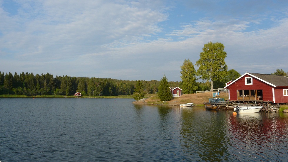
Thunderstorms
are coming up and we are looking for shelter. Looking at the map this
morning we identified Tennviken, perfectly sheltered from all winds
behind a narrow entrance.
On
Google Earth we noted the presence of a few cabins on the South of the
bay. We hope not to disturb holiday-makers too much by anchoring in the
middle. But some of them, sitting on their terrace along the channel,
give a friendly wave and shout “allez les bleus!” Then as we are
sounding the bay to find an appropriate anchoring spot, a man beacons
from the shore: “take that buoy there! It’s mine and I don’t use it
this summer! Welcome!”
The buoy is strong enough and better
sheltered than any anchorage. We are the only yacht in the bay, snuggly
tucked between rocks and cabins. Let the thunderstorms come!
Water
temperature and position in Tennviken. At the same latitude in the
southern hemisphere, we would be only 10 miles from Antarctica...
22nd July : Tennviken (onshore)
It doesn’t blow that hard, but there is thunder and rain. No point in getting out of bed early this morning…
Perfect equipment for the blueberry hunter, protecting both from the rain and the mosquitos!
Once
the worst has passed, we set off in the dinghy to explore the North of
the bay. There is a forest there – therefore, there are blueberries
(and indeed, we’ll pick a full container of big and sweet berries!). As
fesh products start to be rare onboard, nature’s treat is always
welcome. Today a new surprise: raspberries! The first ripe berries that
we see during this trip – and they seem to be thriving just on the
shore, between the rocks.
The coastline is still as pretty
despite the gray sky. 50 shades of granite. The water is blue and
clear, free of the algal blooms that invade parts of the southern
archipelagoes.
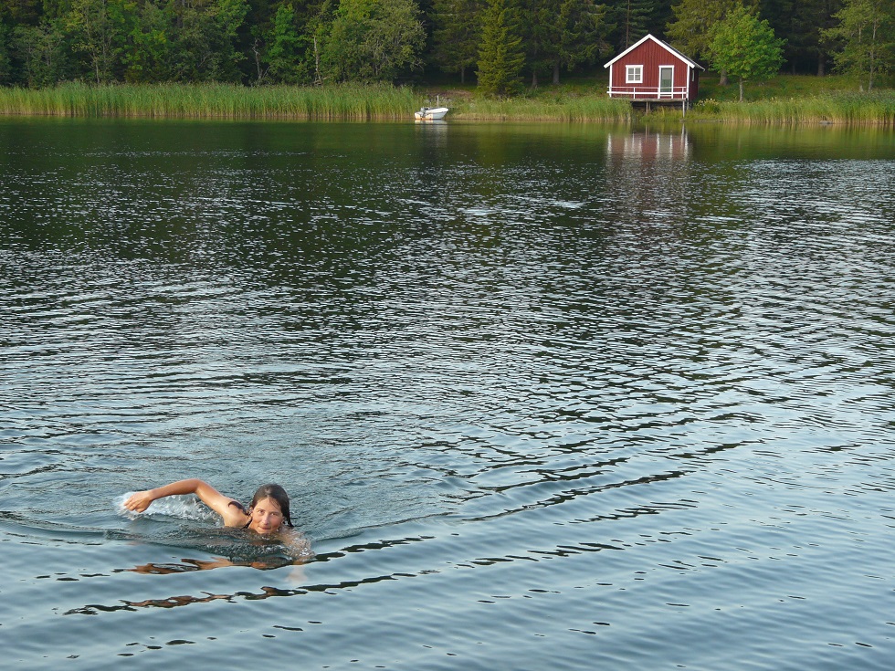
Laure
finds the coastline equally enjoyable from the water, as she goes for a
long swim while Camille bakes some pie and bread. Not that bad a day
for a weather-standby…
Laure at, or rather in, Tennviken
Evening light...
The
storms are gone after 8pm, leaving a clear sky to be enjoyed from the
cockpit at dinner. This was a really nice Swedish parenthesis. Tomorrow
we will leave early to sail to Finland – for the 3rd time since the
start. We can’t seem to stay away from it too long…
SuDad - 27/07/2018 16:38:37 Vous soumettez une nouvelle fois vos supporters à une épreuve redoutable, celle de ne pas (trop) se répéter dans les éloges. On a toujours la réaction de s’extasier devant la beauté des photos, de s’amuser des notations pittoresques que vous collectionnez, d’admirer la rigueur des données « techniques », des relevés de navigation. Et aussi des fiches de géographie, qui nous instruisent sur les réalités de ces pays nordiques, dont nous ne percevions que les lieux communs. Votre « Baltic tour » devient une mission culturelle ( !?!...), heureusement émaillée constamment pour vous de préoccupations mer-à-mer et terre-à-terre des plus distrayantes !!! AUMADATROI - 26/07/2018 19:58:25 De bien beaux petits coins de paradis ! Et en plus de l'eau à 25° !!! Ca donne envie quand même !!! Mum - 26/07/2018 15:33:54 Merveilles de merveilles on apprend,on rêve et on sourit la mamou - 26/07/2018 12:59:30 encore tellement magique , qu'il faut bien une ou deux autres lectures d'affilées !!!